


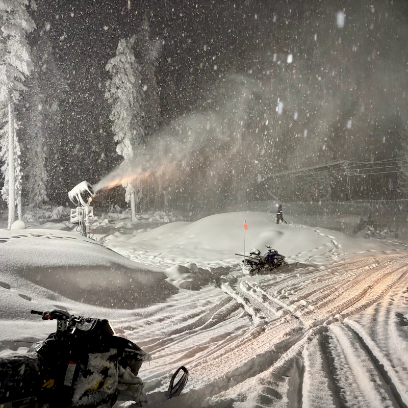
Last night’s system again favored the Wenatchee Mountains, and this time it brought snow levels all the way down toward the outskirts of town. Up at The Ridge, we also lucked out with a moderate overperformance of the forecast! Showers picked up just as our night shift snowmaking crew arrived and kept ramping up as night deepened, keeping the crew inside a snow globe for a good chunk of their shift. As of this morning, we’re looking at around 6 inches at the summit and around 5 lower down. The storm should be tapering off, though a few showers could linger this morning.
Despite the storm, winds stayed nearly calm, leaving the trees coated in a beautiful layer of new snow. But more importantly, it let the snowmaking team keep double dipping, laying down their own snow efficiently even as Mother Nature added her own contribution. Guns ran top to bottom all night, and the night crew handed that setup off to the day crew this morning to keep things cranking as long as conditions permit.
Looking ahead, temps should stay mostly below freezing for the next couple of days, with chances for some incremental natural snowfall. Later in the week, we’re watching a larger system arrive with higher precipitation potential, but also a warming trend. Snow levels could inch toward or above our lower mountain elevations. Here’s to hoping for continued help from Mother Nature and cool temps. Keep an eye on our website, and we’ll keep you updated as conditions continue to take shape.
Summit Forecast
Sunday 11/22: Snow, mainly before 10am. Patchy dense freezing fog after 1pm. High near 21. Calm wind. Chance of precipitation is 80%. Total daytime snow accumulation of around an inch possible.
Monday 11/23: A 40 percent chance of snow, mainly before 10am. Patchy dense freezing fog. Mostly cloudy, with a high near 26. Calm wind becoming southwest around 5 mph. New snow accumulation of less than a half inch possible.
Tuesday 11/24: Snow likely, mainly after 4pm. Patchy freezing fog after 1pm. Mostly cloudy, with a high near 22. North wind around 6 mph. Chance of precipitation is 60%. New snow accumulation of less than one inch possible.
Operating Schedule
Lifts are not yet operating for the 26/27 season. Target Opening Day is Friday, November 27th, weather and conditions permitting. Stay tuned on our website as we will provide continued updates as conditions take shape.
Uphill Policy
Pre-Season Uphill Policy in effect. Please check the full policy before heading up.